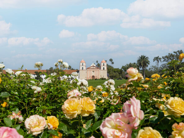
When it comes to combining the mountains and the sea, it’s tough to think of a better place in the country for hiking than Santa Barbara. Nicknamed The American Riviera®, Santa Barbara exudes a Mediterranean feel with its coastline, vegetation and architecture. Hiking trails in Santa Barbara and surrounding areas feature amazing vistas, from easy, flat paths through manicured gardens to challenging climbs that reach towering heights over the Pacific.
SEVEN FALLS
If you’re looking for a moderate hike that ends with a refreshing splash, Seven Falls is right up your alley. Pack those hiking boots and head to Tunnel Road, a paved road that leads straight to a trailhead shared by many well-known hikes. Once the asphalt ends, turn left and slosh your way up the path, but don’t forget to pack your swimsuit! The waterfall’s pools make for a great photo-op, and the 3.4-mile round-trip hike will leave you with a sense of accomplishment (and just a bit of sweat).
Difficulty: Moderate
Length: 3.4 miles (round trip)

LA CUMBRE PEAK
This intermediate hike continues on from the end of Tunnel Trail and is a 10-miler out-and-back type. The stunning ridge, Santa Barbara’s highest peak at 3,995 feet, offers panoramic views of the coast and is a must-do for avid hikers. For the hike to La Cumbre Peak, local guides advise that hikers come prepared with water, sunscreen, protective wear, sturdy boots and snacks. The sun-filled days in Santa Barbara can get pretty toasty, especially as you travel farther from the ocean and into the front country.
Difficulty: Moderate
Length: 10 miles (round trip)

INSPIRATION POINT
You can’t go wrong at any place named Inspiration Point. There are a couple of ways to reach the panoramic views around 1,800 feet above Santa Barbara. Taking San Roque Road to the Jesusita Trail is just under 8 miles round trip, with around 1,400 feet of elevation gain. A shorter alternative is to take Tunnel Road to Jesusita, which is around 3.75 miles round trip, but you don’t have the ocean views on the way up. Whichever way you decide to get there, you’ll enjoy hiking through the oaks and sycamores at lower elevations, and the views at the top are, well, inspirational.
Difficulty: Moderate
Length: 8 miles (round trip) or 3.75 miles (round trip)

CHANNEL ISLANDS
Located just off the coast of Santa Barbara, Channel Islands National Park offers a stunning contrast to the mainland. Isolated for thousands of years, the five islands in the park have developed their own unique plant and animal life, and possess a rugged beauty that shouldn’t be missed. Each island has a unique look and feel to be explored. On Santa Barbara Island, you’ll find 5 miles of hiking trails that climb over low mountain ridges and offer incredible coastal views.
Channel Islands National Park is packed with hiking (and camping) opportunities on these unique outposts in the Pacific.
Difficulty: Easy to Moderate (multiple trails)
Length: 5 miles (one way)

LIZARD’S MOUTH
If you’re looking for more of a picnic setting with space to relax, Lizard’s Mouth is the perfect hike to take on. The easy quarter-mile walk off West Camino Cielo Road opens up to jaw-droppingly scenic views and plenty of room to post up with blankets and a charcuterie board. The iconic rock formation that looks like a lizard opening its mouth is closer to the backside of the boulders and faces away from the ocean. Don’t be surprised if there are a few engagement shoots happening while you explore, the view is just that great!
Difficulty: Easy
Length: 0.3 miles (round trip)

RATTLESNAKE canyon
A gentle 4.5-mile round-trip hike, Rattlesnake Trail is perfect for the whole family, Fido included. The trailhead is adjacent to Skofield Park and marked by a large sign. Follow the shaded trail through its dips and take in all the gorgeous scenery the canyon has to offer. If you’re looking to up the ante, take the connector from the meadow up to Tunnel Trail (see details on how to access below) and prepare yourself for a workout!
Difficulty: Moderate
Length: 4.5 miles (round trip)

GAVIOTA PEAK
The 2,458-foot Gaviota Peak is an excellent challenge for those who want a more serious hike. The 5.9-mile loop trail starts just west of Santa Barbara at Gaviota State Park in Goleta, about a half-hour drive from Downtown Santa Barbara. The peak is just 2 miles inland of the ocean, which means you’re going to have some steep climbing (there is a 2,162-foot elevation gain on the way up), and you’re going to get some excellent views of the Pacific once you get there. From the parking lot just off the 101 Freeway, the trail splits after a short distance, and you can choose to take the mostly single-track Trespass Trail to the top. The trail does loop, however, so you can take the fire road back down for another view.
Be prepared to climb as you hike the trail to the top of Gaviota Peak.
Difficulty: Strenuous
Length: 5.9 miles (loop)

CATHEDRAL PEAK
Towering above the coast, you and your hiking crew will be able to see for dozens of miles at Cathedral Peak. The statuesque boulders are intimidating, and rightfully so! This trail is not for the faint-hearted, and rated for Class 3 rock climbing, so leave your furry friend at home this round. However, seasoned hikers know the strenuous 4-mile round trip with 2,342-foot elevation gain is worth it for the wondrous views and bragging rights that come with signing the coveted registration book nestled in the rocks near the peak. Start on Tunnel Road, take Jesusita Trail to Mission Creek, then turn right up Mission Creek and look left for a steep trail that continues onward toward your destination.
Difficulty: Strenuous
Length: 4 miles (round trip)

NOJOQUI FALLS
This hike at Nojoqui Falls Park may be short (0.8 miles out-and-back), but the payoff is getting to see a spectacular 80-foot waterfall. The park is located about 40 miles from Downtown Santa Barbara, just beyond the Gaviota Tunnel on the 101 Freeway. The hike itself winds its way up 175 feet through a shaded canyon covered with a canopy of oaks and laurels. While at times steep, the wide trail is accessible to anyone, with a scenic wooden bridge and stone steps. The falls are at their strongest in the spring, and become quite powerful after a heavy rain. But even when the falls are a smaller trickle, it’s still a sight to behold.
Difficulty: Easy
Length: 0.8 miles (round trip)

SANTA BARBARA BOTANIC GARDENS
Where else can you find more than 1,000 native California plant species all within walking distance? Just 3 miles from Downtown Santa Barbara, the Santa Barbara Botanic Garden is a great place to explore on your own or with a docent to help you discover everything to see in this 78-acre preserve. You’ll find more than 5 miles of paths to explore everything from cool redwood groves to meadows full of wildflowers in the spring. The Porter Trail offers the best scenic views of the area. You’ll also find an authentic Japanese Teahouse and Garden, as well as the historic Mission Dam, which was built in 1807 to provide water for the Santa Barbara Mission. The 1.3-mile out-and-back Tipton Trail begins in the Pollinator Garden and connects hikers with the eastern section of the gardens.
Difficulty: Easy
Length: 5 miles
Los Padres TUNNEL TRAIL
One of the most popular Santa Barbara hikes, Tunnel Trail hits its quota for amazing city views, twists, turns, rock formations and breathtaking waterfalls during the rainy season. Beginning on the same paved road (Tunnel Road) as Inspiration Point, Cathedral Peak and Seven Falls, Tunnel Trail winds around the mountain and lands at East Camino Cielo Road, with views of the rugged backside of the Santa Ynez range. It’s up to you how long you want to make your hike, but on average the hike is about 7.5 miles — with a few extra miles tacked on if you continue on to La Cumbre Peak. Be sure to wear sturdy shoes and bring lots of water, and don’t forget your camera to capture the insane heights.
Difficulty: Moderate
Length: 7.5 miles (round trip)

DISCLAIMER: Hiking is an inherently dangerous activity. Please research all hikes before embarking, and adequately prepare yourself and your group with ample water, hiking shoes, food, medical supplies and anything else you may need* to ensure a safe and enjoyable hike. Before going, please confirm the trail is open and safe for hiking. Please check the Los Padres National Forest, California State Parks, Santa Barbara County Parks and City of Santa Barbara Parks websites for the most current information.
*Kindly note that restroom and trash services may be limited or non-existent, so be sure to plan ahead and pack out any trash.
Frequently Asked Questions
What are the best hikes in Santa Barbara for beginners or families?
Hikes that are best for beginners and families with children include Inspiration Point, the Channel Islands, Lizard’s Mouth, Rattlesnake Trail, Nojoqui Falls and the Santa Barbara Botanic Garden.
Note: Difficulty levels vary depending on which trail you choose and the age of the children, so it’s best to plan carefully.
Which Santa Barbara hikes offer the best ocean views?
For scenic ocean views in Santa Barbara, choose these hikes:
- La Cumbre Peak
- Inspiration Point
- Channel Islands
- Lizard’s Mouth
- Gaviota Peak (near the summit)
- Cathedral Peak (near the summit)
- Los Padres Tunnel Trail
Are there any must-do hikes near Downtown Santa Barbara?
Some of the closest hikes to Downtown Santa Barbara include:
- Santa Barbara Botanic Garden
- Rattlesnake Trail
- Inspiration Point
- Tunnel Trail
Note: Distance from Downtown Santa Barbara depends on where you begin your hike and how far you’re going.
What are the best hikes in Santa Barbara with waterfalls?
Feel the rush of waterfalls when you hit these trails:
- Seven Falls
- Inspiration Point to Seven Falls
- Rattlesnake Trail
- Nojoqui Falls
- Los Padres Tunnel Trail to Seven Falls
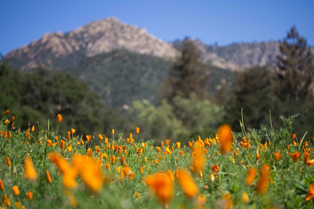
Which Santa Barbara trails showcase the best wildflowers or spring blooms?
While many trails offer a chance to see vibrant wildflowers during blooming season, these provide the best displays:
- Tunnel Trail to La Cumbre Peak
- Channel Islands
- Trespass Trail to Gaviota Peak
- Santa Barbara Botanic Garden
- Los Padres Tunnel Trail
What is the best time of year to go hiking in Santa Barbara?
Santa Barbara is a year-round hiking destination, thanks to its mild coastal climate, but each season offers its own rewards.
- Spring is one of the most popular times to hit the trail. Expect blooming wildflowers, cooler temperatures and lush greenery.
- Summer brings longer daylight hours and clear skies, especially in the mountains and front country. Morning “June Gloom” usually burns off by midday, but you’ll want to start early to avoid warm inland temperatures.
- Fall is a local favorite. Crowds thin out, the weather is stable and temperatures stay warm without being too hot.
- Winter can be stunning, with vibrant green hillsides, fewer visitors and cooler hiking conditions. Winter rains can make waterfalls more impressive, but some trails may be muddy, so check conditions before heading out.
No matter the season, arriving early is key for finding parking and enjoying quieter trails.
Are dogs allowed on Santa Barbara hiking trails?
Bring your four-legged companion along on these trails:
- Seven Falls
- Tunnel Trail to La Cumbre Peak
- Jesusita Trail to Inspiration Point
- Lizard’s Mouth
- Rattlesnake Trail
- Cathedral Peak
- Nojoqui Falls
- Santa Barbara Botanic Garden
- Los Padres Tunnel Trail
Note: Dogs must be leashed, and always remember to pick up after your pet.
What are the best sunrise or sunset hikes in Santa Barbara?
Experience sunrise or sunset at their best on these hikes with high-elevation views:
- La Cumbre Peak
- Inspiration Point (sunset only)
- Channel Islands National Park
- Lizard’s Mouth
- Rattlesnake Canyon
- Gaviota Peak
What should I bring on a hike?
Be prepared for your outdoor adventure in Santa Barbara with hiking essentials like:
- Water bottle
- Flashlight
- First-aid kit
- Snacks
- Portable phone charger
- Socks
- Light jacket