The breathtaking and must-see sights of Santa Barbara are beautifully captured in a designated driving tour that covers 25 miles. Fittingly named, The Santa Barbara Scenic Drive, this tour takes approximately one hour to follow without stopping. That said, it’s all about the stops and photo ops along the way, so we recommend giving yourself at least two hours or, better yet, a half-day to complete the full tour. Here’s a play-by-play of the route…
Location 1
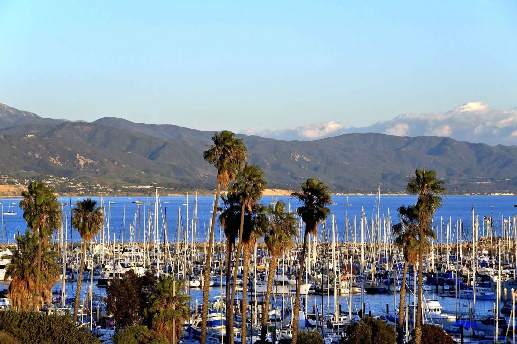
Start on Cabrillo Boulevard heading west. After one mile, you’ll reach the Santa Barbara Harbor, which is well worth a stop. We highly recommend walking out to the breakwater for an eye-catching vantage of the city nestled beneath the towering Santa Ynez mountains. Along the way, see fishermen bringing in their hauls and, if you’re hungry, stop for a bite to eat at one of the seafood-centric eateries.
Location 2
Continue west along Cabrillo Boulevard, which becomes Shoreline Drive. Park yourself at Shoreline for breathtaking views of the crescent of Santa Barbara’s most iconic coastline that curves from the Harbor to East Beach and beyond to Montecito. During the gray whale migration December through April, you might even spot whales breaching!
Location 3
About 2 miles from the Harbor, Shoreline Drive bends to the right and comes to a stoplight at Cliff Drive. You’ll now be entering a neighborhood is known as The Mesa. Turn left here and continue straight on Cliff Drive for about 1 mile until you come to the roundabout at Las Positas Road. Go halfway around the traffic circle to continue on Cliff Drive.
Location 4
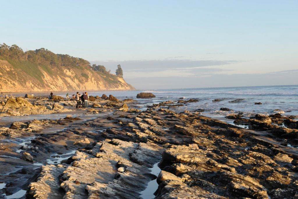
Soon on the left, you’ll see the parking lot for Arroyo Burro Beach, known by locals as “Hendry’s Beach.” This beautiful stretch of sand is popular for surfing, viewing tide pools, and walking along the beach. The especially dog-friendly beach is off-leash to the left and on-leash to the right. And Boathouse at Hendry’s Beach is a tasty spot for a meal or cocktail with ocean views.
Location 5
When you’re ready, continue along Cliff Drive to a stop sign located about 1 mile from Hendry’s Beach just after passing a scenic overlook. Turn left and note the sign indicating that you are entering Hope Ranch, an upscale residential community featuring elegant homes and palm-tree-lined roads. Named after Thomas Hope, an Irishman who purchased the land in 1861 for sheep ranching, Hope Ranch was first developed as a residential area in 1923.
Location 6
Marina Drive turns into Roble Drive for a short time and then becomes Las Palmas Drive. Continue on Las Palmas Drive, past the golf course on your right. to a stop sign. You’ll pass a wrought iron gate signed “Hope Ranch” as you exit the neighborhood.
Location 7
Go straight ahead, passing over the 101 freeway to La Cumbre Road. The La Cumbre Plaza Shopping Center will be on your right. Continue on La Cumbre Road crossing State Street, Santa Barbara’s main street. About 1 mile after State Street, you’ll stop at the light at Foothill Road. Turn right on Foothill Road, also known as Route 192. This is a stunning backroad many visitors don’t see unless they are in the know.
Location 8
Drive along Foothill Road for about 2.5 miles, passing through a number of traffic lights to the first stop sign at Mission Canyon Road. Turn right here and, in 0.6 miles, you will find yourself at the Old Mission Santa Barbara. The “Queen of the Missions” is the 10th in California’s network of 21 missions built by the Spanish between 1769 and 1833. It’s the only one to be continuously occupied by the Franciscans and is noted for its twin bell towers.
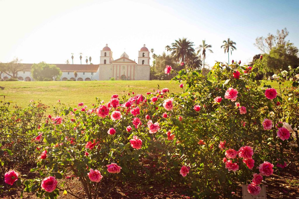
Location 9
After visiting the Mission and the Rose Garden across the street, head back towards Foothill Road but take the first right past the Mission, onto Alameda Padre Serra (locals call it “APS”). Driving along APS is the Riviera neighborhood, which features sweeping, elevated views of the City, the Pacific Ocean, and The Channel Islands.
Location 10
Continue on APS along the ridge until the road starts to head downward and you come to a roundabout, about 2.5 miles from the Mission. Go through the roundabout, taking the third exit up the hill continuing on Alameda Padre Serra which becomes Eucalyptus Hill Road and then Alston Road.
Now you’re in Montecito, another upscale residential enclave. Montecito boasts some of the most spectacular and expensive real estate in the United States and is home to the rich and famous. Think big names like Oprah Winfrey, Ellen Degeneres and Rob Lowe.
Location 11
Continue on Alston Road to a stop sign and turn left on Hot Springs Road. Continue on Hot Springs Road until you come to the 2nd stop sign (after about 0.3 miles). Turn left staying on Hot Springs Road and head north towards the mountains. Go to the 1st stop sign and turn right on East Valley Road passing the beautiful, photogenic Our Lady of Mount Carmel Church.
Location 12
Continue on East Valley Road for about 0.5 miles. You’ll pass through Montecito’s “Upper Village” area featuring some lovely shops and restaurants worth stopping for. Turn right at the first traffic light on San Ysidro Road. Continue on this road south for 1 mile to a stop sign and turn right on N. Jameson Lane, which runs parallel to the north side of the 101 freeway.
Location 13
At the 1st stop sign (about 0.4 miles), continue straight on Coast Village Road, driving through Montecito’s “Lower Village” retail and dining district. If you’re ready to stretch your legs, make a detour at the stop sign. Instead of continuing straight, turn left to cross over the 101 and head towards the iconic Butterfly Beach across from the Four Seasons Resort The Biltmore Santa Barbara.
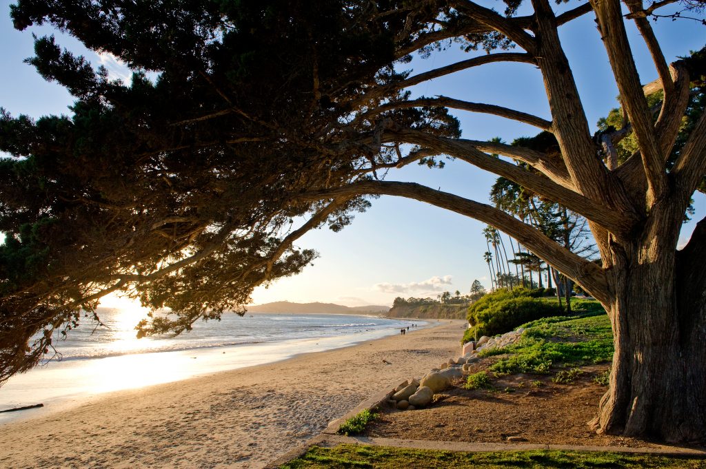
Location 14
After a walk on the beach, make a u-turn to return to Coast Village Road, where you’ll turn left. Coast Village Road will end at the roundabout, with the Montecito Country Mart on your right. Take the 3rd exit on the roundabout, going under the freeway. Continue on Cabrillo Boulevard.
Location 15
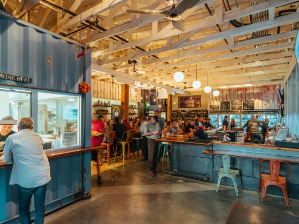
The Bird Refuge will be on your right, with views of the Santa Barbara Zoo perched on the hillside above. On your left will be East Beach, which is a popular spot for beach volleyball. Continue along until you find yourself back at the Santa Barbara Visitor Center and the gateway to The Funk Zone neighborhood.